Hurricane Dorian heads for the US mainland
This Florida brewery is filling up its fermenters with water to help in case of a community crisis
Grove Roots Brewing in Winter Haven, Florida, had to put its operations on hold this week due to Hurricane Dorian, but its staff wanted to help the community.
Instead of letting their sterilized fermenters sit empty, they decided to fill them up with 1,500 gallons of water. Now, in the event of a water crisis, members of the community of about 40,000 people can get water from the brewery.
Brewery owner Joe Dunham told CNN earlier this week:
We are first and foremost a community-centric brewery. We believe in our small town and will do all we can to help people. If the need arises, we will have plenty of water to share. It’s the least we can do for the community we love.
Dunham spoke with CNN's Fredricka Whitfield on Saturday. You can see that interview below:
Most businesses in Freeport, Bahamas, are shuttered and store shelves are almost empty
CNN's Patrick Oppmann is in Freeport, Bahamas, on the island of Grand Bahama, where he says an "eerie stillness" has taken hold.
Oppmann writes:
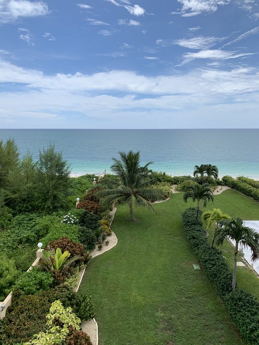
A beautiful day so far in Freeport, Bahamas but you can see something is off. “The calm before the storm” is what everyone always says and yet there is that eerie stillness. Few people are on the street, most businesses are shuttered and store shelves near empty.
See his tweet below:
A beautiful day so far in Freeport, Bahamas but you can see something is off. “The calm before the storm” is what everyone always says and yet there is that eerie stillness. Few people are on the street, most businesses are shuttered and store shelves near empty.
See Patrick Oppmann CNN's other Tweets
South Carolina's governor has declared a state of emergency
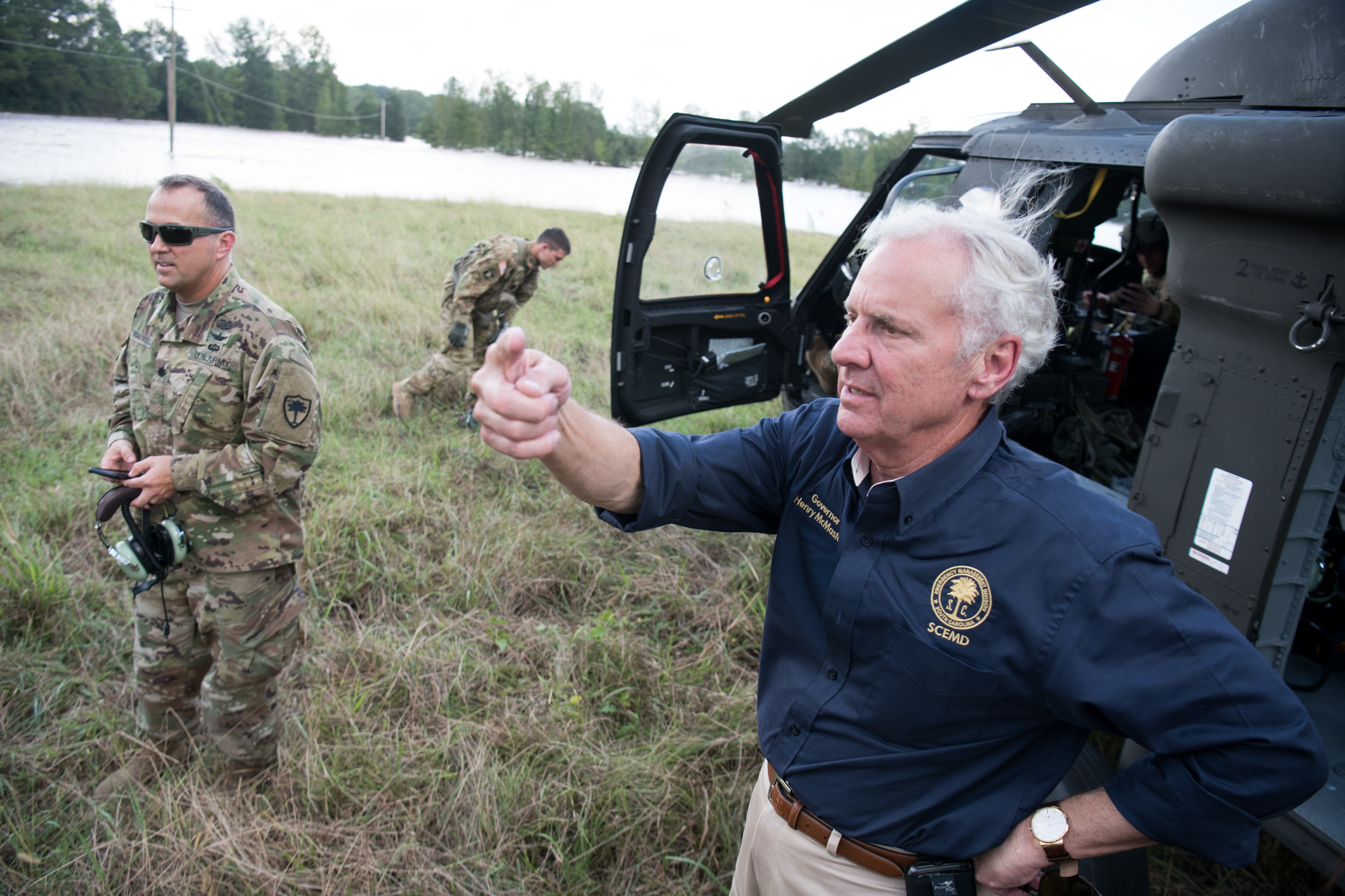
South Carolina Gov. Henry McMaster issued an executive order Saturday declaring a state of emergency, telling residents of his state to prepare for possible impacts by Hurricane Dorian, according to a news release from McMaster's office.
"The executive order enables all state agencies to coordinate resources and sets into effect the State Emergency Operations Plan," the release said.
McMaster wrote on Twitter that authorities are "working around the clock to be ready, if necessary."
"We encourage all South Carolinians who may be impacted by Hurricane Dorian to be vigilant and prepare now -- there is no reason for delay."
Bahamas Prime Minister: You risk your life if you don't evacuate

As communities on the US mainland keep an eye on Dorian's track, the northwestern Bahamas could get slammed, with strong winds arriving soon as Saturday night.
Bahamian Prime Minister Hubert Minnis issued a dire warning in a news conference, according to CNN affiliate WPLG, telling residents, "Do not be foolish and try to brave out this hurricane. The price you may pay for not evacuating is your life."
Dorian is forecast to slow down over the Bahamas, creating what National Hurricane Center Director Ken Graham called "an incredibly dangerous situation."
The slowdown would mean the Bahamas could be subjected to powerful hurricane-force winds, heavy rain and storm surge for an extended period of time.
"Rain, wind and the storm surge keeps piling up," Graham said. "Anybody viewing us from the Bahamas, listen to the local officials. I can't stress this enough."
Florida Power & Light: Be prepared for extensive power outages
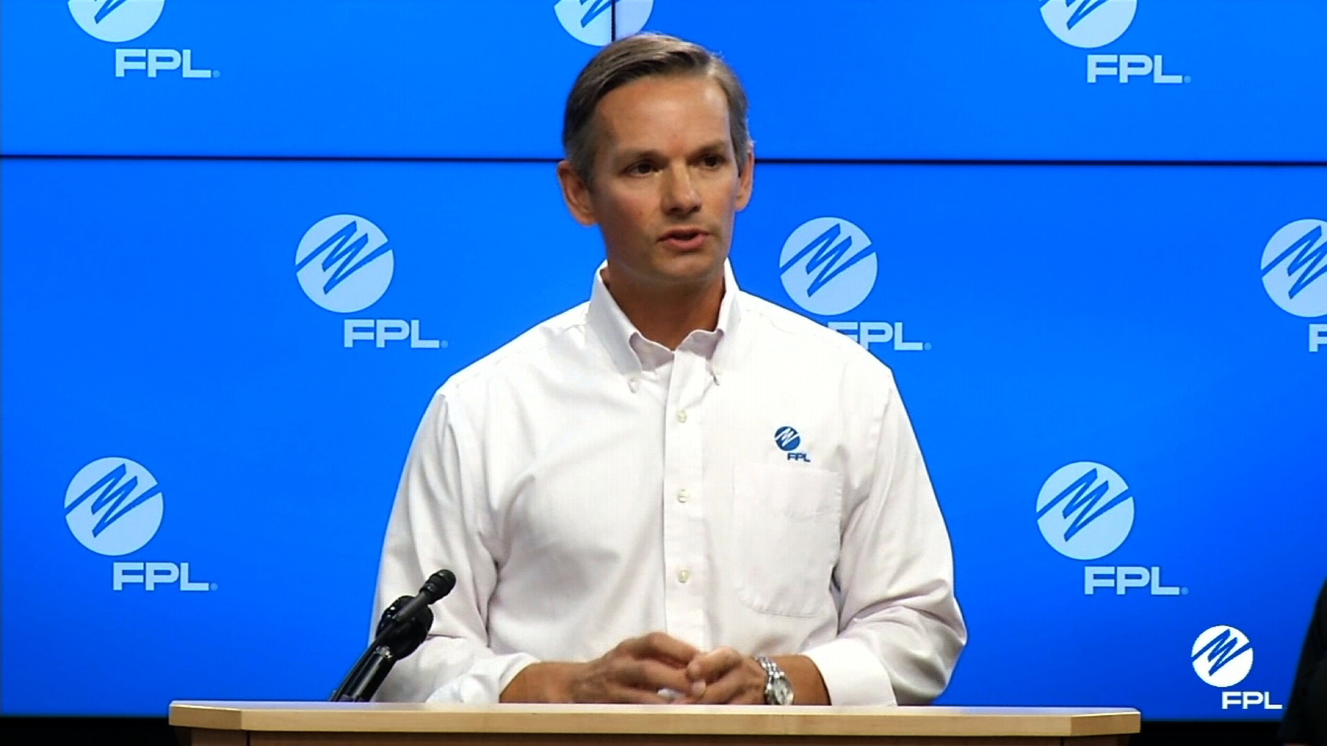
Even though Dorian's path has shifted, Florida residents should still prepare for "possible extensive power outages," Florida Power & Light spokesman Bryan Garner said.
Dorian is still a dangerous and powerful storm, Garner said in a briefing at the electric utility's command center in Riviera Beach, and residents could feel the storm's wind bands as early as Sunday.
FPL will keep preparing as if Florida were at risk of a direct hit, Garner said. There are about 18,000 workers gathering in the state, and crews are ready to stage near the areas expected to be "hardest hit," he said.
Dorian is packing sustained winds of 150 mph
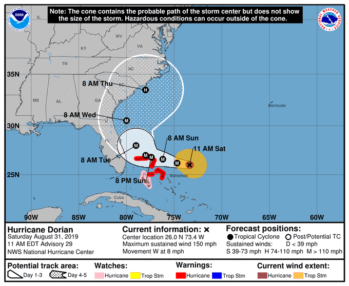
Hurricane Dorian has grown slightly stronger and now boasts maximum sustained winds of 150 mph, according to the National Hurricane Center's 11 a.m. ET advisory.
That means the storm's wind strength is just 7 mph shy of Category 5 hurricane status.
Dorian's forward movement also slowed a bit, the advisory said. It's now heading west at just 8 mph.
The 11 am EDT/AST advisory for Hurricane #Dorian is now available at hurricanes.gov: Dorian's Fury Aiming for the Northwestern Bahamas
600 people are talking about this
Miami-Dade County mayor: It's "too early to let our guard down"
Miami-Dade County Mayor Carlos Gimenez urged residents to continue their storm preparations despite the latest forecasts, telling them it's "still too early to let our guard down."
"Small changes can have a major impact," Gimenez said Saturday. The area can still expect tropical-storm weather and flooding, especially with the King Tides expected over the weekend and into Tuesday, the mayor said.
Trump: The storm is "very hard to predict"
President Trump weighed in on the latest forecasts for Hurricane Dorian, now that the possibilities for landfall include not just Florida but also the coasts of Georgia and the Carolinas.
"Looking like our great South Carolina could get hit MUCH harder than first thought. Georgia and North Carolina also," the President wrote. "It's moving around and very hard to predict, except that it is one of the biggest and strongest (and really wide) that we have seen in decades. Be safe!"
Trump said earlier Saturday morning that he was "monitoring Hurricane Dorian and receiving frequent briefings and updates."
See the President's tweet below:
Looking like our great South Carolina could get hit MUCH harder than first thought. Georgia and North Carolina also. It’s moving around and very hard to predict, except that it is one of the biggest and strongest (and really wide) that we have seen in decades. Be safe!
11K people are talking about this
Look inside Dorian's eye
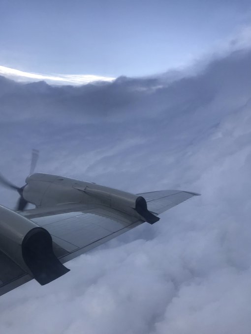
A team from National Oceanic and Atmospheric Administration (NOAA), aboard a Hurricane Hunter P-3 Aircraft, flew into Dorian's eye Saturday.
The eye is the center of the storm. If you are in it, you can see the stadium effect — where the clouds stack up like a sporting arena. It is the calmest part of the storm. You can even see blue sky during the day and stars at night.
Here a look inside the clear eye of #Dorian this morning from the @HRD_AOML_NOAA Hurricane Hunter P-3 Aircraft. Picture credit Paul Chang
2,431 people are talking about this
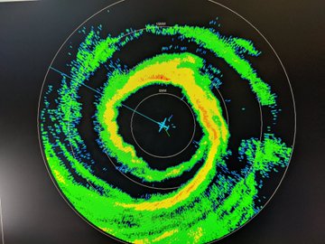
According to the National Hurricane Center, the trip provided useful data on the Category 4 hurricane's inner core and showed the eye being a little bigger than 5 nautical miles.
564 people are talking about this
Areas further north like Georgia and the Carolinas could also bear the brunt of Dorian
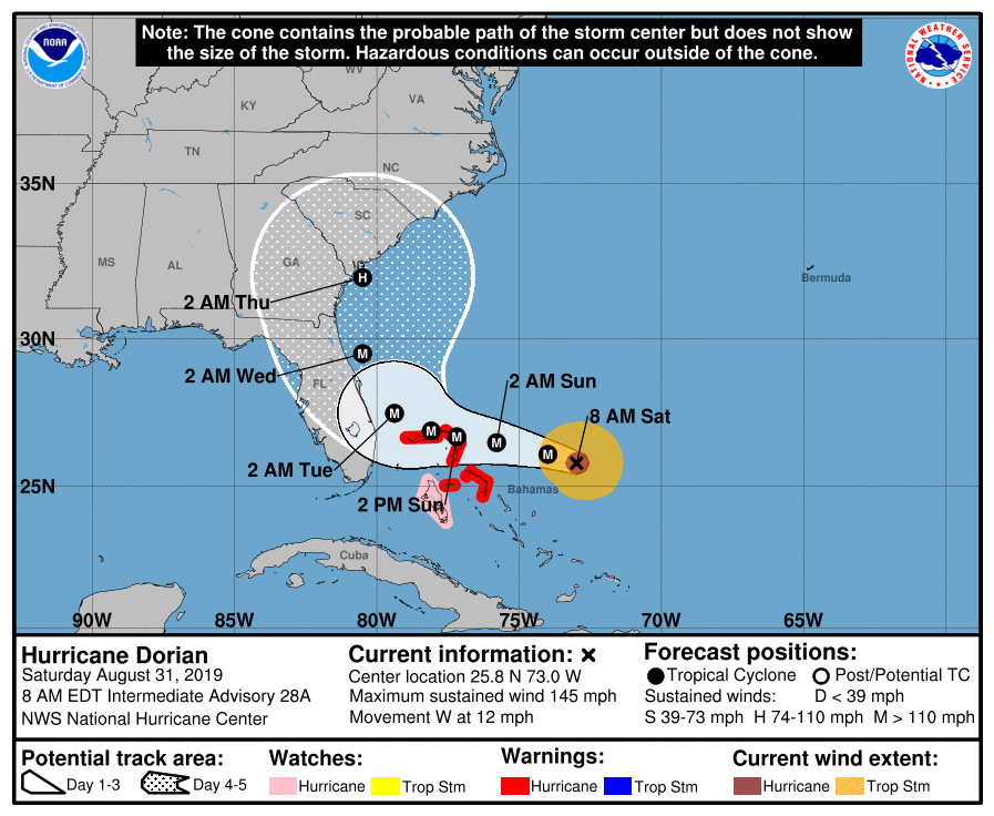
Dorian is now an even stronger 145 mph hurricane, category 4 storm, according to the 8 a.m. advisory from the National Hurricane Center.
It is likely to remain a very intense hurricane today as it moves towards the northern Bahamas, where hurricane warnings remain in effect.
Hurricane watches may be issued for parts of the Florida East Coast later on today.
The forecast track, which was shifted east in an earlier advisory, no longer shows a landfall in Florida. But Floridians should not relax just yet.
Much of Florida remains in the “cone of uncertainty” meaning even a small shift would bring the very dangerous core of the storm inland to Florida.
Even if the storm doesn’t make landfall in Florida, much of the state will still experience life threatening storm conditions like hurricane force winds, storm surge, and flash flooding.
If the current forecast verifies, it will be very similar to the track taken by Hurricane Matthew, a storm that did nearly $5 billion worth of damage in Florida, Georgia and the Carolinas.
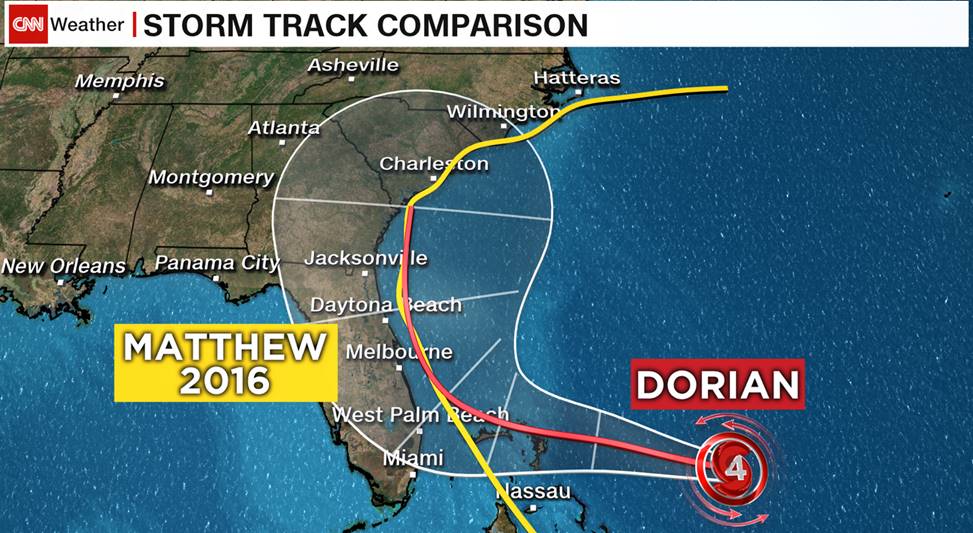
The timing is similar to the previous forecast for the U.S. with tropical storm force winds arriving Sunday night and hurricane conditions possible late Monday into Tuesday.
With the current forecast, Georgia and the Carolinas are now at risk for landfall on Wednesday into Thursday.
And the hurricane could cause catastrophic damage in the Bahamas Sunday into Monday, particularly on Abaco and Grand Bahama Islands.







0 Commentaires